
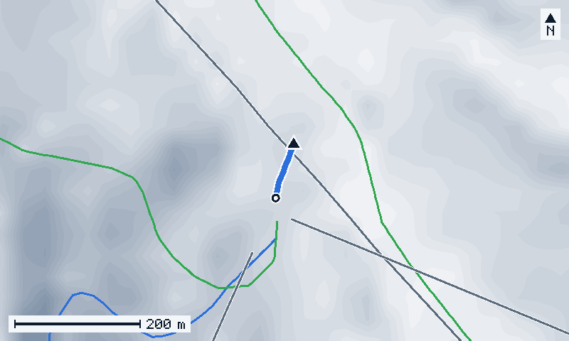
Map of the run
Hover or tap a line for its name and numbers; click to open its page.
© OpenStreetMap · IGN · swisstopo · Copernicus · Credits
- this run
- lifts
- ▲ top
- ○ end
- north is up
Keyboard: Tab goes through the lines, Enter opens one, + and − zoom, the arrows move the map.
Elevation profile
Hover, tap or use the arrow keys along the run: gradient, distance and altitude of each 50 m stretch. The point follows on the map.
Steepest 20 m: 20 %, 10 m from the top
- under 15 %
- 15–25 %
- 25–35 %
- 35–50 %
- over 50 %
Similar runs nearby
- Jonction Bleue d'Arare189 m · ↓ 25 m · 23 % · avg. 13 %
- Barmettes283 m · ↓ 36 m · 18 % · avg. 13 %
- Trashers214 m · ↓ 26 m · 16 % · avg. 12 %
- All the steepest runs of Portes du Soleilranked by gradient
Runs of Portes du Soleil with the closest gradient and vertical drop.
How it ranks in Portes du Soleil
- #306 of 380steepest 20 m
- #259 of 381average gradient
- #360 of 381vertical drop
- #375 of 381length
Among the 381 named runs of Portes du Soleil measured by GeoPeaks. 1 run is left out: its line climbs back up, or has a short pitch far steeper than the rest — maybe a bridge, a tunnel or a cut that the bare-ground relief does not show. Steepest · Longest · Biggest drop
Questions
How long is Mossettes?
Mossettes is 90 m long, measured horizontally along its line, and drops 12 m, from 1,594 m to 1,582 m.
How steep is Mossettes?
Its average gradient is 14 %; its steepest 20 m reach 20 %, 10 m from the top.
Where does Mossettes end?
It ends at 1,582 m, near Avoriaz.
What difficulty is Mossettes?
OpenStreetMap marks it as: Blue.
| Length (horizontal) | 90 m 295 ft |
|---|---|
| Top | 1,594 m 5,230 ft |
| Bottom | 1,582 m 5,190 ft |
| Vertical drop | 12 m 39 ft |
| Average gradient | 14 % |
| Steepest 20 m | 20 % |
| Difficulty | Blue (As mapped in OpenStreetMap) |
Start at the top of Mossettes, in the browser of a computer.
Ski this run in 3D