
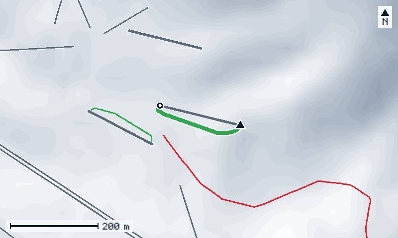
Map of the run
Hover or tap a line for its name and numbers; click to open its page.
© OpenStreetMap · IGN · swisstopo · Copernicus · Credits
- this run
- lifts
- ▲ top
- ○ end
- north is up
Keyboard: Tab goes through the lines, Enter opens one, + and − zoom, the arrows move the map.
Elevation profile
Hover, tap or use the arrow keys along the run: gradient, distance and altitude of each 50 m stretch. The point follows on the map.
Steepest 20 m: 30 %, 70 m from the top
- under 15 %
- 15–25 %
- 25–35 %
- 35–50 %
- over 50 %
Similar runs nearby
- Douanier230 m · ↓ 28 m · 30 % · avg. 12 %
- Panoramique672 m · ↓ 109 m · 32 % · avg. 16 %
- La Forgne1.12 km · ↓ 175 m · 31 % · avg. 16 %
- All the steepest runs of Portes du Soleilranked by gradient
Runs of Portes du Soleil with the closest gradient and vertical drop.
How it ranks in Portes du Soleil
- #248 of 380steepest 20 m
- #234 of 381average gradient
- #331 of 381vertical drop
- #341 of 381length
Among the 381 named runs of Portes du Soleil measured by GeoPeaks. 1 run is left out: its line climbs back up, or has a short pitch far steeper than the rest — maybe a bridge, a tunnel or a cut that the bare-ground relief does not show. Steepest · Longest · Biggest drop
Questions
How long is Lac?
Lac is 216 m long, measured horizontally along its line, and drops 35 m, from 1,683 m to 1,648 m.
How steep is Lac?
Its average gradient is 16 %; its steepest 20 m reach 30 %, 70 m from the top.
Which lift goes to the top of Lac?
The top of Lac is reached by Coquelets (Drag lift), Débutants (Drag lift), and Lac (Drag lift).
Where does Lac end?
It ends at 1,648 m, near Châtel.
What difficulty is Lac?
OpenStreetMap marks it as: Green.
| Length (horizontal) | 216 m 709 ft |
|---|---|
| Top | 1,683 m 5,522 ft |
| Bottom | 1,648 m 5,407 ft |
| Vertical drop | 35 m 115 ft |
| Average gradient | 16 % |
| Steepest 20 m | 30 % |
| Difficulty | Green (As mapped in OpenStreetMap) |
Start at the top of Lac, in the browser of a computer.
Ski this run in 3D